
Action Plan
Hazardous Fuel Reduction in Pescadero Canyon, Carmel-by-the-Sea
Phase Alpha: Immediate Clearance of Carmel-by-the-Sea City Parcels in Pescadero Canyon
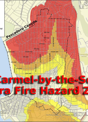
Immediate hazardous fuel reduction within the six Carmel-by-the-Sea-controlled parcels located along the eastern perimeter of Pescadero Canyon between Camino Real and Casanova Street, as identified in the attached map and Fire Defense Plan.
Focus exclusively on the removal and reduction of overgrown weeds, grasses, ivy, ladder fuels, and other hazardous vegetation within these city parcel boundaries in Pescadero Canyon.
Fuel mitigation methods may include targeted goat grazing, hand crews, mechanical trimming, or other approved vegetation management techniques.
Utilize the City of Carmel-by-the-Sea’s currently budgeted $150,000 hazardous fuel reduction line item for the current fiscal year to fund this immediate work.
Prioritize rapid implementation on the east rim of the canyon to establish defensible space protections for homes bordering 2nd Avenue and adjacent canyon edges.
This Phase Alpha effort is limited solely to Pescadero Canyon fuel mitigation activities within the six city-owned parcels and does not include unrelated city projects, parks, or broader vegetation programs.
The effort aligns with Sections 8 and 9 of the City’s 2025/2026 Defensible Space Priorities and associated Fire Defense Plan mapping for Pescadero Canyon.
Phase Bravo: Coordinated Multi-Agency Pescadero Canyon Fuel Reduction
Expand hazardous fuel reduction efforts beyond the six Carmel-by-the-Sea parcels into adjacent canyon properties owned or managed by:
Pebble Beach Community Services District (PBCSD)
Del Monte Forest Conservancy (DMFC)
California American Water (Cal-Am)
Additional cooperating canyon landowners and agencies
Via the Wildfire Preparedness Committee, coordinate future fuel reduction zones so that completed and planned clearance projects connect continuously throughout Pescadero Canyon, reducing wildfire spread potential across jurisdictional boundaries.
Support ongoing collaboration between the Carmel-by-the-Sea Fire Department and the Del Monte Forest Conservancy to establish mutually agreed-upon goals, objectives, and treatment boundaries, including potential clearance beyond the currently highlighted purple-shaded areas on the project map.
Encourage cooperative planning with PBCSD and CAL FIRE to integrate existing and future canyon fuel mitigation projects into a unified wildfire defense strategy.
Recognize that portions of the proposed treatment area fall under multiple ownership jurisdictions, requiring collaboration and coordination rather than unilateral action.
Emphasize that the immediate priority remains the prompt clearance of the six Carmel-by-the-Sea-owned parcels without delay while broader interagency agreements continue to develop.
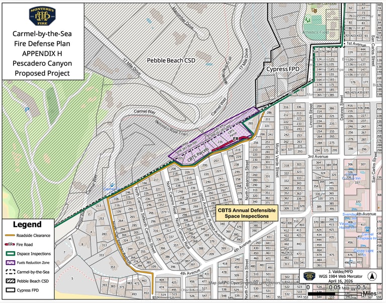
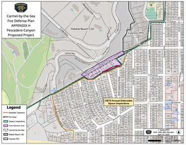
Reference the attached Fire Defense Plan Appendix H map showing proposed Pescadero Canyon fuels reduction zones, fire roads, roadside clearance areas, and overlapping jurisdictional ownership.
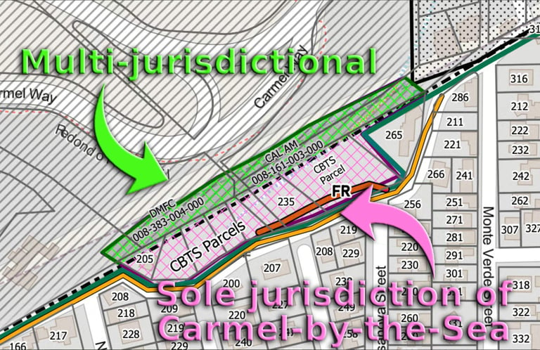
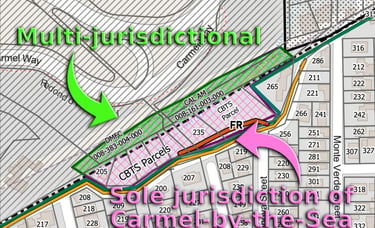
Phase Alpha covers the purple/pink-hatched area east of the black dotted line for lot 205, CBTS Parcels, lot 235, and CBTS Parcel.
Complete Carmel-by-the-Sea Fire Defense Plan
Appendix H: Pescadero Canyon

Call/Email the City Sign the Petition Donate ©2026. All rights reserved. Privacy policy